Parks & Nature
15 places · Natural escapes in the DMV

Boulder, CO
Chautauqua Park
A historic 26-acre park and National Historic Landmark at the base of the Flatirons, established in 1898 as part of the Texas-Colorado Chautauqua. The open meadow provides the most classic foreground for photographing the Flatirons. The historic cottages and dining hall add architectural interest to the natural setting.
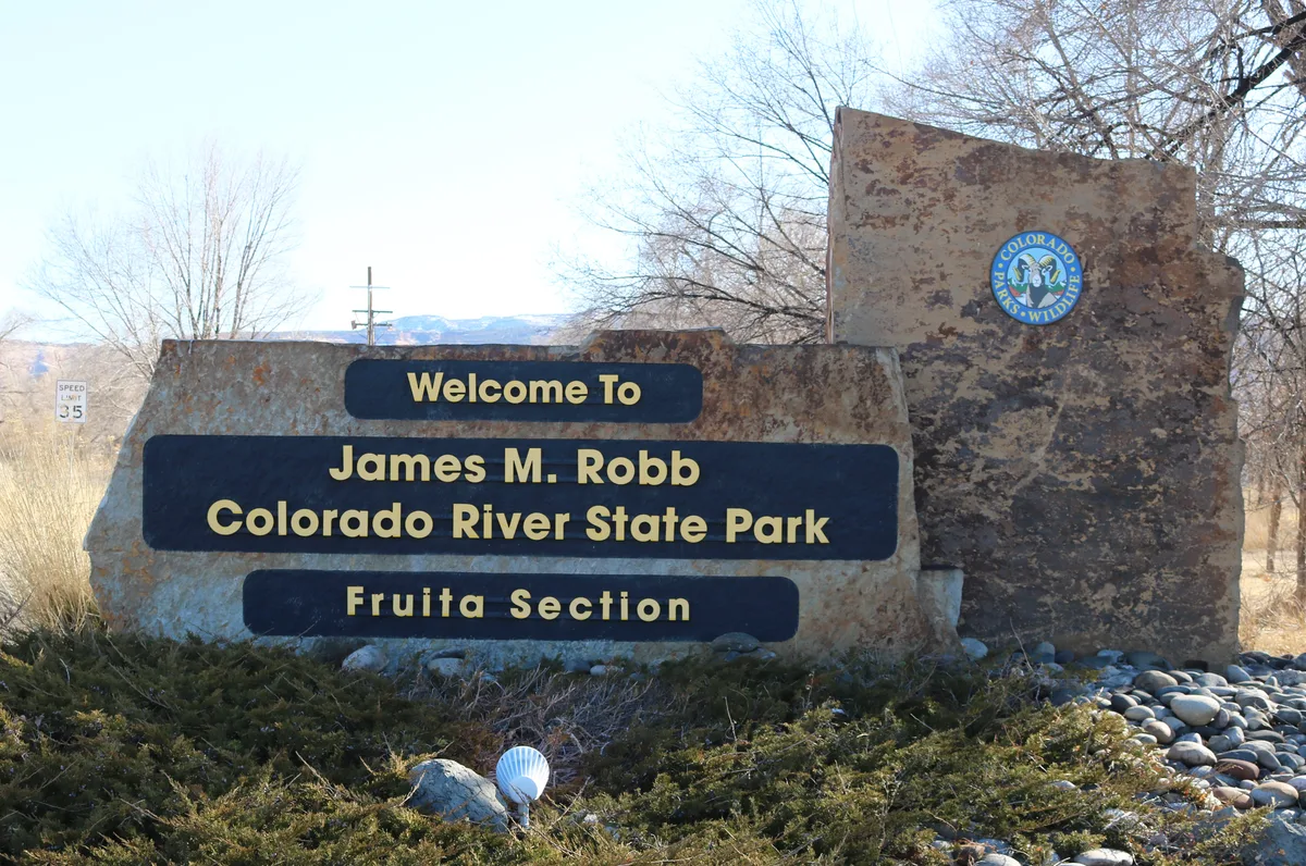
Grand Junction, CO
Colorado River State Park - Connected Lakes
Connected Lakes section of James M. Robb Colorado River State Park features several reclaimed gravel pit lakes adjacent to the Colorado River. The calm lakes provide mirror reflections of the Book Cliffs and surrounding mesas. Great blue herons, bald eagles, and ospreys frequent the area year-round.

Colorado Springs, CO
Garden of the Gods
A public park featuring dramatic red sandstone formations that were deposited in a horizontal position and tilted vertically by the same geological forces that created the Rocky Mountains. Balanced Rock and Kissing Camels are among the most photographed features. Pikes Peak provides a stunning backdrop to the red rock formations.

Fort Collins, CO
Horsetooth Rock
A distinctive rock formation at 7,255 feet elevation in Horsetooth Mountain Open Space that resembles a horse's tooth. The 6.4-mile round trip hike gains about 1,700 feet of elevation and provides views of Fort Collins, Horsetooth Reservoir, and the Great Plains. The rock formation is a prominent landmark visible from much of the city.

Denver, CO
Daniels Park
A Denver Mountain Park at 6,200 feet elevation that is home to a free-roaming herd of American bison. The park offers views of the Front Range from Pikes Peak to Longs Peak along a scenic drive. The combination of bison and mountain backdrop creates unique wildlife photography opportunities near the metro area.

Denver, CO
Roxborough State Park
A state park featuring dramatic red sandstone formations of the Fountain and Lyons formations that jut skyward at steep angles along the Front Range. The park is designated as both a Colorado Natural Area and a National Natural Landmark. Scrub oak and grasslands between the rock fins change color dramatically in autumn.

Morrison, CO
Matthews/Winters Park
A Jefferson County Open Space park on the Dakota Hogback featuring the Red Rocks Trail that passes through tilted red sandstone formations. The park preserves remnants of the 1859 townsite of Mount Vernon and includes both foothill grasslands and riparian areas. Views extend from the hogback formations across the plains to Denver.
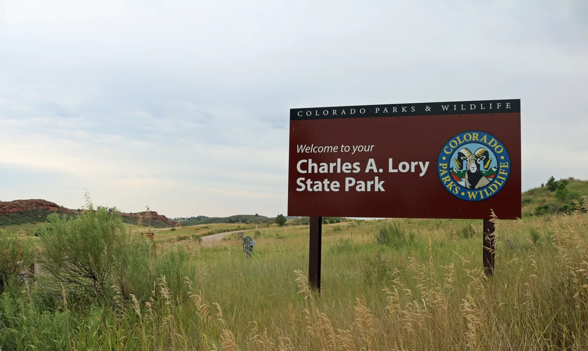
Fort Collins, CO
Lory State Park
A 2,479-acre state park on the western shore of Horsetooth Reservoir featuring foothills, hogbacks, and valleys. Arthur's Rock at 6,780 feet provides panoramic views of Fort Collins, the reservoir, and the Great Plains. The park's varied terrain supports diverse habitats from grasslands to dense forests.
Estes Park, CO
Horseshoe Park and Sheep Lakes
A wide glacial valley near the Fall River entrance to Rocky Mountain National Park where bighorn sheep frequently visit mineral licks at Sheep Lakes. The open meadow provides unobstructed views of Mummy Range and Deer Mountain. Elk also frequent the valley at dawn and dusk throughout the year.
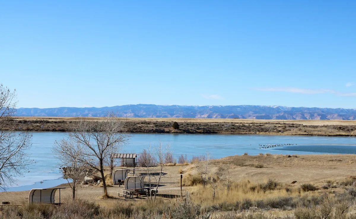
Fruita, CO
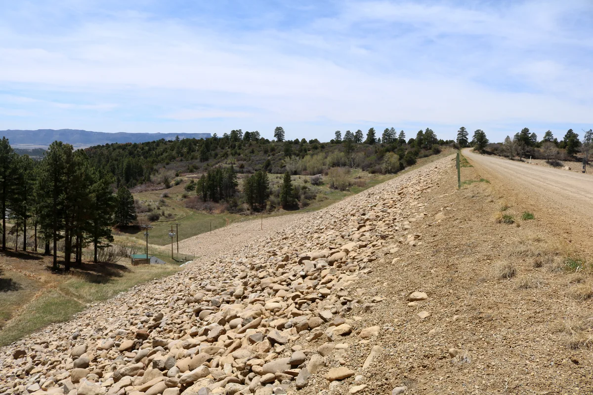
Highline Lake State Park
Highline Lake is a 170-acre reservoir set against the backdrop of the Book Cliffs in the high desert north of Fruita. The lake's calm morning waters create mirror reflections of the surrounding mesa and cliff landscape. Mack Mesa and the distant La Sal Mountains are visible from the shoreline.
Mancos, CO
Mancos State Park
Mancos State Park is centered around Jackson Gulch Reservoir at an elevation of 7,800 feet, surrounded by Gambel oak and ponderosa pine forests. The La Plata Mountains provide a dramatic backdrop visible from the reservoir's eastern shore. The park offers quiet lakeshore access with opportunities for reflection photography and wildlife observation.
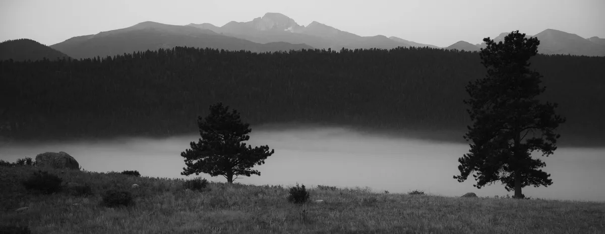
Estes Park, CO
Moraine Park
A broad glacial valley at 8,000 feet where elk herds gather during the fall rut from mid-September through October. The Big Thompson River meanders through the meadow with Longs Peak visible to the south. Bugling elk and dramatic morning mist make this a premier wildlife photography location.
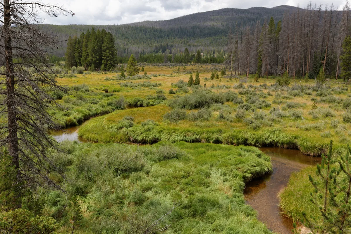
Grand Lake, CO
Kawuneeche Valley
A lush glacial valley along the Colorado River headwaters on the west side of Rocky Mountain National Park. The valley floor is a mosaic of willow thickets, wet meadows, and the meandering young Colorado River. Moose are frequently seen in the willows, and the valley's aspen groves produce vibrant fall color.
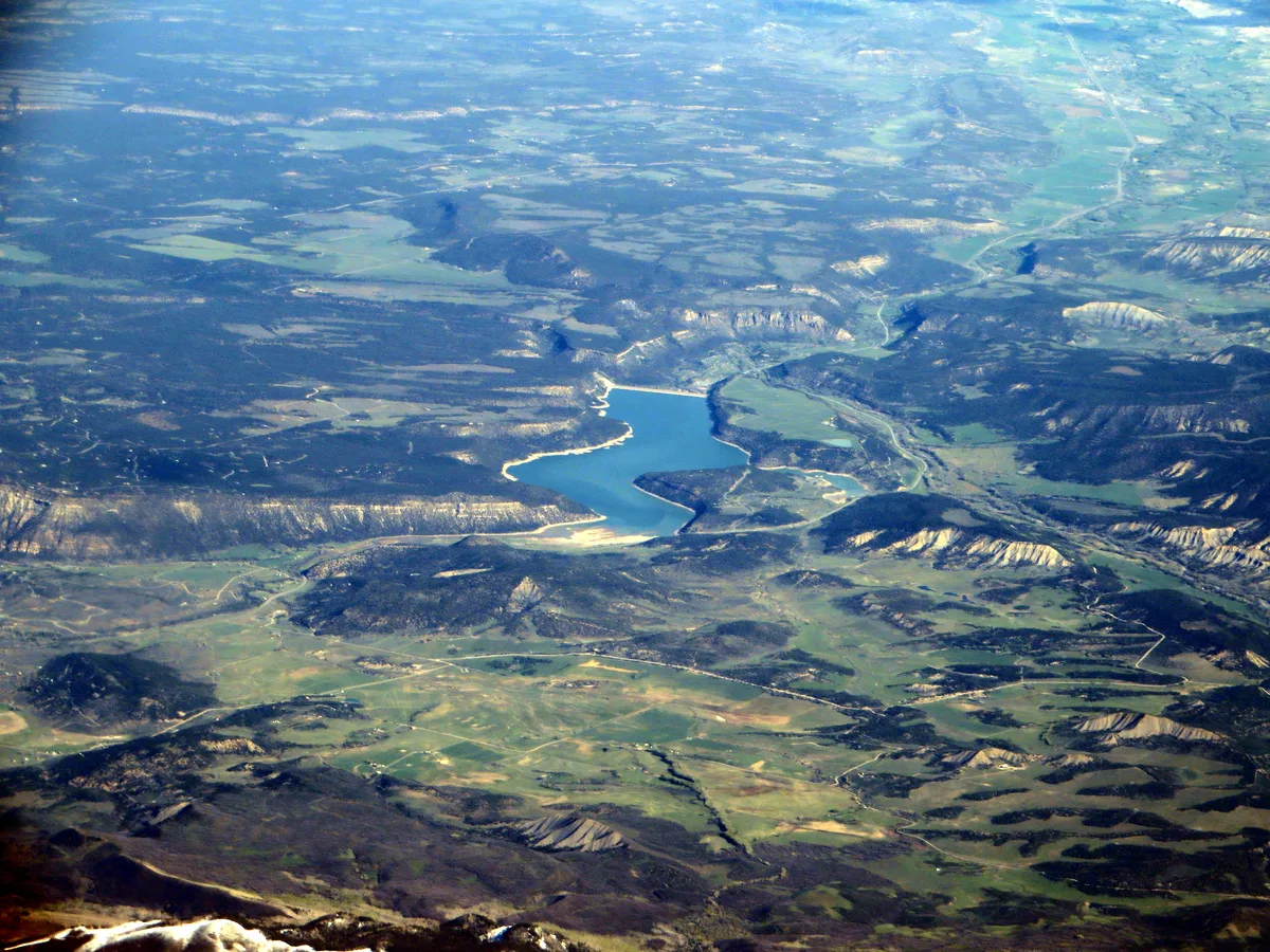
Montrose, CO
Ridgway State Park - Dallas Creek Arm
The Dallas Creek arm of Ridgway Reservoir provides a classic foreground for photographs of the Sneffels Range, including Mount Sneffels at 14,150 feet. The reservoir reflects the surrounding peaks when winds are calm. Fall cottonwoods along the shore add seasonal color framing the mountain views.

Keystone, CO
Lily Pad Lake
A small, shallow alpine lake reached via a gentle 3-mile round trip trail through lodgepole pine and aspen forest near Keystone Resort. The lake surface is dotted with lily pads in summer, creating foreground texture for mountain reflections. Wildflowers line the trail in July, and moose are occasionally spotted in the wetlands near the lake.