Photogenic Places
40 places · Ranked by scenic score

Boulder, CO
Flatirons Vista
The Flatirons are five large tilted slabs of sedimentary rock on the southwest slope of Green Mountain in Boulder. These iconic rock formations rise dramatically from the foothills at angles of 40 to 50 degrees. The formations are visible from much of Boulder and serve as the city's most recognizable landmark.

Morrison, CO
Red Rocks Amphitheatre
A naturally formed amphitheatre surrounded by 300-foot red sandstone monoliths that date back 290 million years. The venue sits at 6,450 feet elevation and is surrounded by a park with hiking trails offering views of the rock formations and Denver skyline. The red sandstone glows intensely during golden hour light.

Denver, CO
City Park and Ferril Lake
Denver's largest urban park features Ferril Lake, which provides one of the most iconic reflection shots of the Denver skyline with the Rocky Mountains behind it. The 330-acre park was designed in the City Beautiful tradition and includes mature tree-lined paths. The lake's calm morning surface creates mirror-like reflections of the skyline.

Fort Collins, CO
Horsetooth Reservoir
A 6.5-mile-long reservoir nestled against the foothills west of Fort Collins, formed by four dams on the eastern slope. The reservoir's distinctive hogback setting creates dramatic landscapes, especially when combined with sunset light. The water reflects the surrounding foothills and produces vivid colors at dawn and dusk.
Estes Park, CO
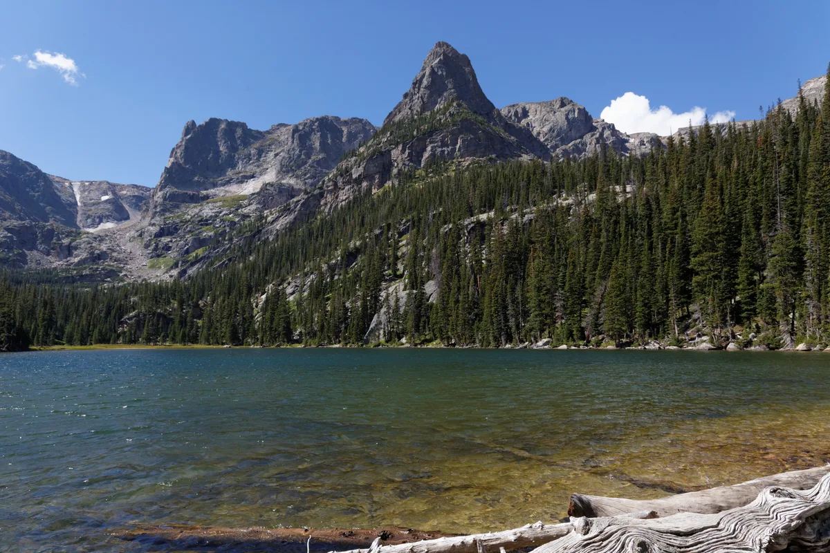
Bear Lake
A high-elevation lake at 9,450 feet surrounded by Hallett Peak and Continental Divide peaks. The lake's calm morning waters create near-perfect reflections of the surrounding mountains. It is one of the most accessible alpine lakes in Rocky Mountain National Park.
Cortez, CO
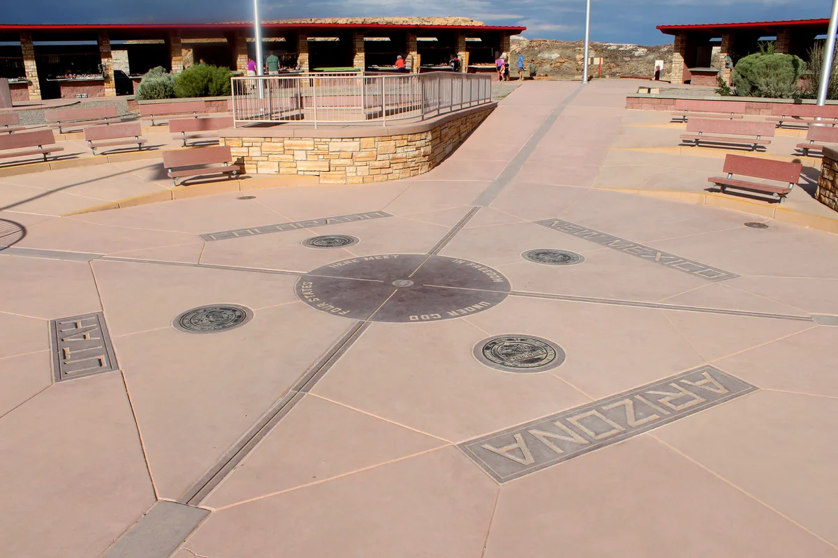
Four Corners Monument
Four Corners Monument marks the only point in the United States where four states meet: Colorado, New Mexico, Arizona, and Utah. The site is managed by the Navajo Nation and features a bronze marker set into a granite platform. The surrounding high desert landscape of red earth and distant mesa formations provides a stark, open backdrop.

Estes Park, CO
Sprague Lake
A small, accessible lake at 8,710 feet with a half-mile paved loop trail. The lake provides reliable reflections of the Continental Divide including Hallett Peak and Flattop Mountain. The site is wheelchair accessible and located along a short spur road from Bear Lake Road.
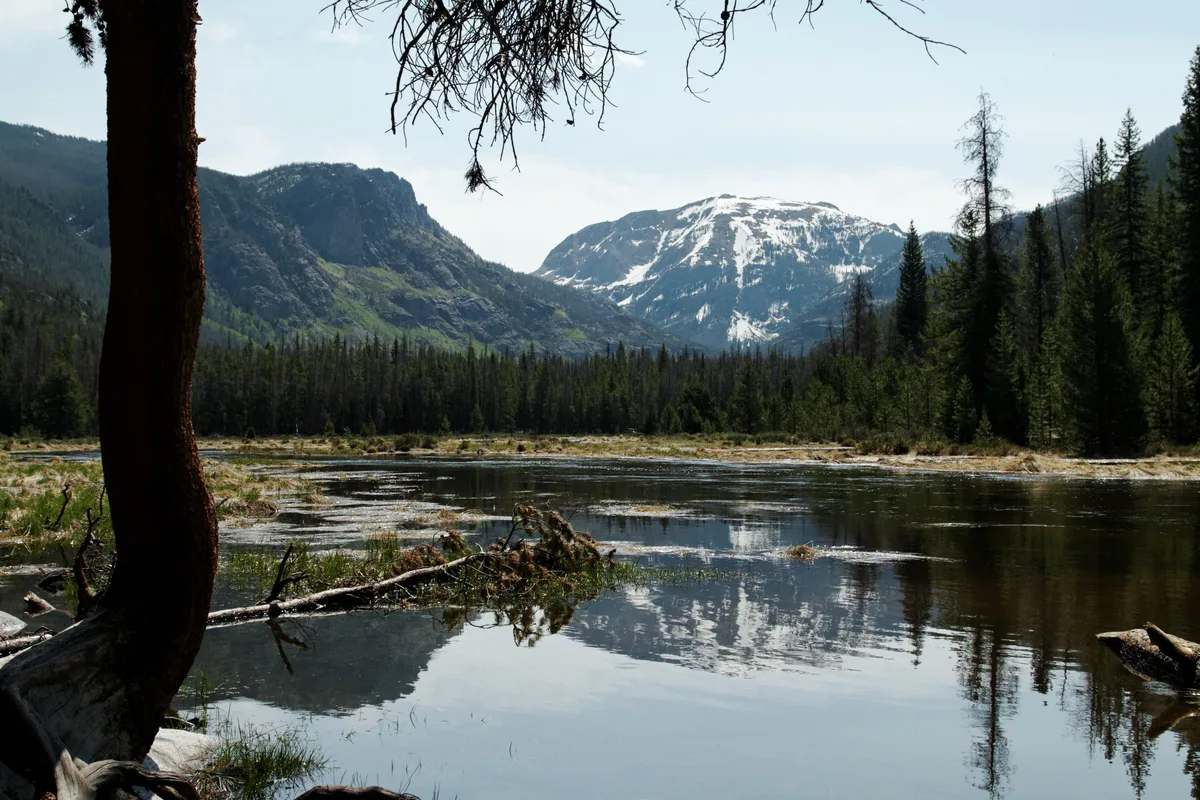
Grand Lake, CO
Grand Lake
Colorado's largest natural lake at 8,369 feet, located at the western entrance to Rocky Mountain National Park. The lake is bordered by the town of Grand Lake and offers views of Mount Craig and Mount Baldy to the east. Morning fog frequently settles over the lake surface, creating atmospheric photography conditions.

Ward, CO
Brainard Lake
A high-elevation lake at 10,345 feet in the Indian Peaks Wilderness area, offering clear views of the Continental Divide including Mount Audubon and Paiute Peak. The lake is vehicle-accessible and provides a starting point for trails to Long Lake and Lake Isabelle. In winter, the area is popular for snowshoeing and offers snow-capped peak reflections.
Creede, CO
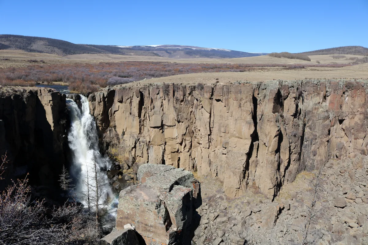
North Clear Creek Falls
North Clear Creek Falls is a 100-foot waterfall that plunges over a rhyolite cliff into a rocky gorge. A short paved trail leads to an overlook with a direct view of the falls surrounded by dense spruce forest. The waterfall is located along the Silver Thread Scenic Byway between Lake City and Creede.
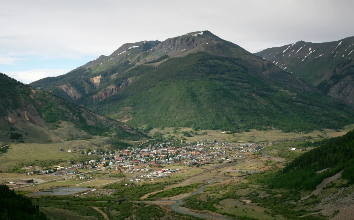
Silverton, CO
Silverton Historic District
Silverton's entire downtown is a National Historic Landmark District with well-preserved Victorian-era mining town architecture dating from the 1880s and 1890s. Greene Street features colorful storefronts, the 1902 Town Hall, and the Grand Imperial Hotel against a dramatic backdrop of 13,000-foot peaks. The town sits at 9,318 feet in a high mountain basin surrounded by the San Juan Mountains.

Telluride, CO
Telluride Town and Box Canyon
Telluride sits at 8,750 feet within a dramatic glacially carved box canyon surrounded on three sides by steep mountain walls reaching 13,000 feet. The town's Victorian-era Colorado Avenue is framed by the surrounding peaks and multiple visible waterfalls including Ingram Falls and Bridal Veil Falls. The free gondola between Telluride and Mountain Village provides aerial perspectives of the entire valley.
Fruita, CO
Rabbit Valley - Trail Through Time
Rabbit Valley is a paleontological area near the Colorado-Utah border featuring exposed Morrison Formation dinosaur fossils along an interpretive trail. The arid desert landscape includes eroded badlands, juniper-dotted hills, and views toward the distant La Sal Mountains. The area sits at the western edge of Colorado's canyon country.

Dolores, CO
McPhee Reservoir
McPhee Reservoir is the second-largest body of water in Colorado, impounded on the Dolores River with a surface area of 4,470 acres. The reservoir is surrounded by pinon-juniper woodlands and mesa terrain with views of the San Juan Mountains to the east. Several access points along the shoreline provide varied photographic perspectives.
Towaoc, CO
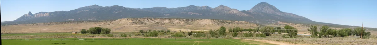
Sleeping Ute Mountain
Sleeping Ute Mountain is a laccolith formation rising to 9,984 feet that resembles a sleeping figure when viewed from the east or west. The mountain is sacred to the Ute Mountain Ute Tribe and is located on the Ute Mountain Ute Reservation. The profile is best photographed from various vantage points along US-160 and US-491 near Cortez and Towaoc.

Denver, CO
Confluence Park
Located at the confluence of Cherry Creek and the South Platte River, this urban park marks the site where Denver was founded in 1858. The park offers views of the downtown Denver skyline, river features, and the REI flagship store in a renovated historic building. Kayakers and tubers in summer add dynamic foreground elements.

Denver, CO
Denver Union Station
A Beaux-Arts train station built in 1881 and renovated in 2014, featuring the iconic 'Travel by Train' neon sign on its facade. The interior Great Hall features original architectural details with modern design elements, creating a blend of historic and contemporary aesthetics. The exterior plaza includes fountains and the iconic sign that glows at twilight.

Breckenridge, CO
Breckenridge Historic Main Street
A well-preserved Victorian mining town main street lined with colorful 1880s-era buildings, now housing shops and restaurants. The Tenmile Range rises dramatically behind the town, creating a classic mountain town composition. The street is part of the Breckenridge Historic District, listed on the National Register of Historic Places.
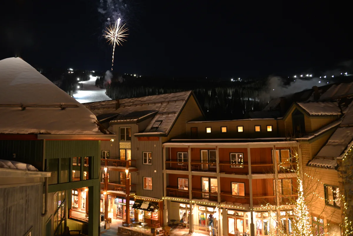
Keystone, CO
Keystone Lake and River Run Village
A small alpine lake at the base of Keystone Resort reflects the surrounding peaks and resort architecture. The lake freezes in winter and is maintained as a skating rink, creating unique nighttime photography opportunities with resort lighting. River Run Village offers European-inspired pedestrian streets with mountain backdrops.

Vail, CO
Vail Village
A pedestrian-only Bavarian-inspired alpine village at the base of Vail Mountain with timber-frame architecture, covered bridges, and Gore Creek running through its center. The village was built in the 1960s to emulate European ski resort aesthetics and has become an iconic Colorado mountain town. In winter, the village is blanketed in snow with festive lighting.
Boulder, CO
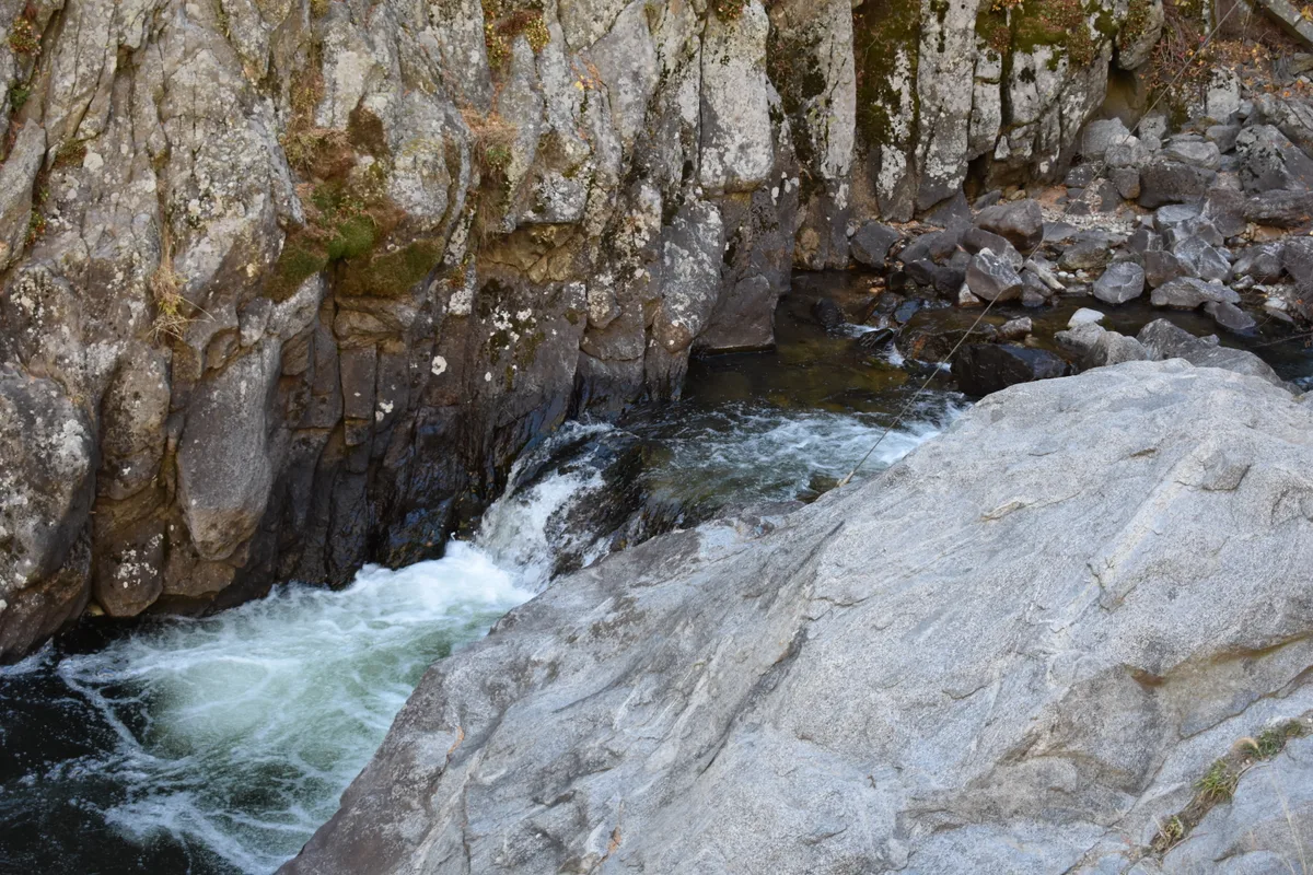
Boulder Falls
A 70-foot waterfall on North Boulder Creek located in Boulder Canyon along Highway 119. The falls cascade over a granite cliff face into a narrow canyon. Peak flow occurs during late spring snowmelt, typically from May through June.
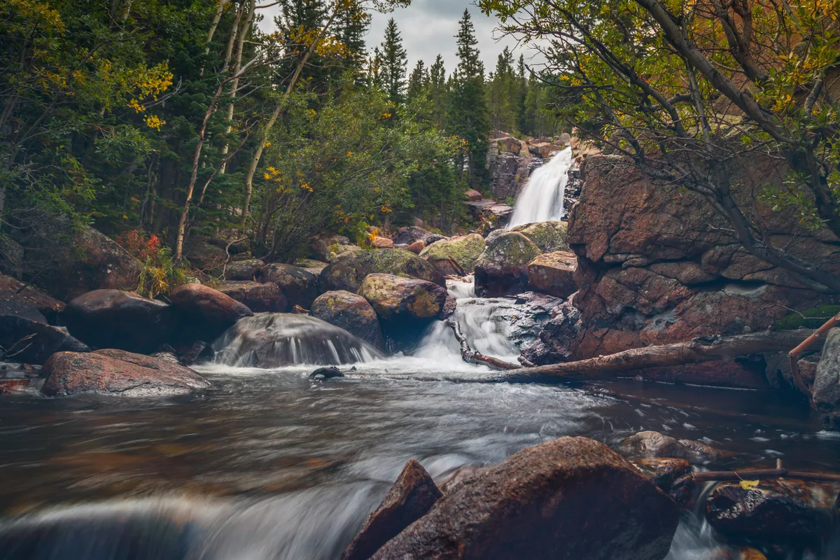
Estes Park, CO
Alberta Falls
A 30-foot cascade on Glacier Creek located 0.8 miles from the Glacier Gorge Trailhead at 9,400 feet elevation. The waterfall flows through a narrow granite gorge and is most powerful during spring snowmelt in late May and June. Surrounding subalpine forest frames the falls with spruce and fir trees.
Grand Lake, CO
Adams Falls
A 55-foot waterfall on East Inlet Creek accessible via a short 0.3-mile trail from the East Inlet Trailhead near Grand Lake. The falls cascade over mossy granite ledges through a narrow canyon. Peak flow occurs during June snowmelt when the falls are at their most photogenic.
Estes Park, CO
Lily Lake
A small roadside lake along Highway 7 at 8,927 feet with a 0.8-mile paved loop trail. The lake offers reflections of Longs Peak and Mount Meeker from its southeast shore. Lily pads cover portions of the lake surface in summer, adding foreground interest to photographs.

Estes Park, CO
Estes Park Elkhorn Avenue and Downtown
The downtown area of Estes Park sits at 7,522 feet with the Big Thompson River flowing through the center of town. Elk routinely walk through the commercial district, particularly during the fall rut. The Stanley Hotel, perched on a hill above downtown, provides a distinctive architectural subject with mountain backdrops.
Telluride, CO
Bridal Veil Falls
At 365 feet, Bridal Veil Falls is the tallest free-falling waterfall in Colorado. A historic hydroelectric power plant sits at the top of the falls and is one of the oldest alternating current power plants still operating in the world. The falls are visible from the east end of Telluride's box canyon.

Telluride, CO
Last Dollar Road
Last Dollar Road is a high-mountain dirt road connecting Telluride to Ridgway via Dallas Divide, passing through vast aspen groves with views of the Wilson Range and Mount Sneffels Wilderness. In autumn, the road is surrounded by dense golden aspens that create some of the most photographed fall color scenes in Colorado. Split-rail fences and old ranch meadows add foreground interest.
Lake City, CO
Lake San Cristobal
Lake San Cristobal is the second largest natural lake in Colorado, formed approximately 700 years ago by the Slumgullion Earthflow landslide that dammed the Lake Fork of the Gunnison River. The lake is surrounded by dense forests and mountain peaks that provide vivid fall color reflections. It is located two miles south of the historic mining town of Lake City.

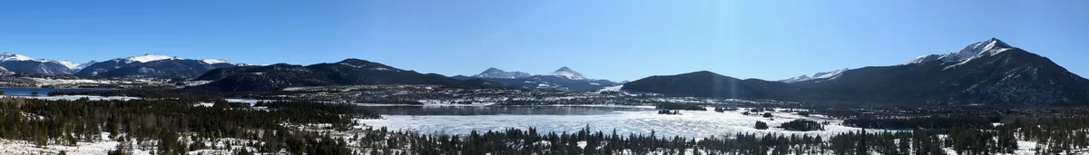
Dillon, CO
Dillon Reservoir
A 3,233-acre reservoir surrounded by mountain peaks, offering expansive reflection opportunities on calm mornings. The reservoir sits at 9,017 feet elevation with views of the Tenmile Range, Gore Range, and Continental Divide. A paved recreation path circles much of the shoreline, providing multiple vantage points.
Frisco, CO
Frisco Bay Marina
A marina on the western arm of Dillon Reservoir providing foreground interest of docked sailboats against the backdrop of the Tenmile Range. The bay faces east, making it an excellent sunrise location with warm light illuminating the peaks. A pedestrian path along the waterfront connects to the Frisco Historic Park.

Denver, CO
Denver Botanic Gardens
A 24-acre botanical garden in the Cheesman Park neighborhood featuring over 50 themed gardens and collections adapted to the semi-arid climate. The Boettcher Memorial Tropical Conservatory and the iconic Monet Pool provide year-round photography subjects. The gardens display over 33,000 plants from regions around the world.

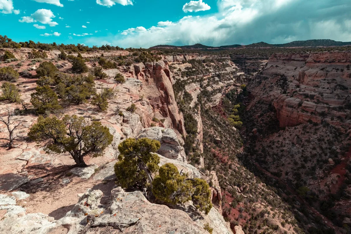
Fruita, CO
Miracle Rock - Colorado National Monument
Miracle Rock is a large balanced sandstone boulder perched precariously on a narrow pedestal along the Monument Canyon Trail. The formation demonstrates dramatic erosional forces that shaped the monument's landscape. The trail also passes by the Kissing Couple and other sandstone monoliths.

Fruita, CO
Devil's Kitchen - Colorado National Monument
Devil's Kitchen is a natural rock amphitheater of eroded sandstone spires and boulders within Colorado National Monument, reached by a short 1.5-mile round-trip trail. The enclosed red rock formations create intimate scenes with dramatic upward perspectives. Early morning light penetrates the rock enclosure and illuminates the sandstone walls.

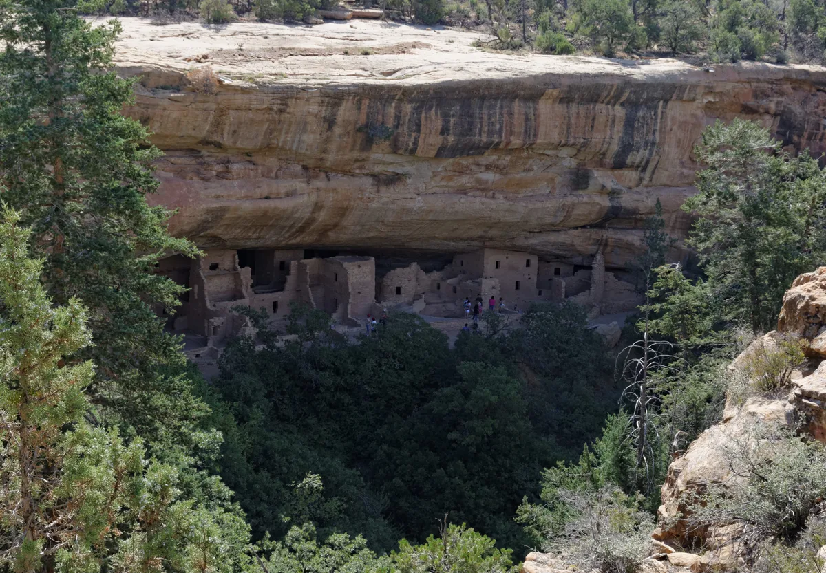
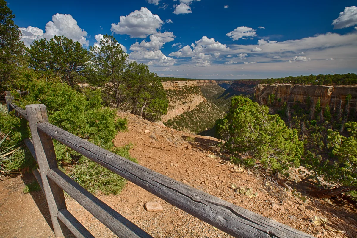
Mancos, CO
Cliff Palace
Cliff Palace is the largest cliff dwelling in North America, containing approximately 150 rooms and 23 kivas built by Ancestral Puebloans around 1190-1260 CE. The alcove structure is nestled beneath a massive sandstone overhang in a canyon wall within Mesa Verde National Park. The site is accessible only via ranger-guided tours during the open season.

Mancos, CO
Balcony House
Balcony House is one of the most dramatic cliff dwellings in Mesa Verde National Park, accessible only by climbing a 32-foot ladder and crawling through a narrow tunnel. The site contains about 40 rooms and two kivas tucked into a south-facing alcove on the cliff face. The approach provides striking views down Soda Canyon.
Mancos, CO
Spruce Tree House
Spruce Tree House is the third-largest cliff dwelling in Mesa Verde, containing about 130 rooms and 8 kivas built between 1211 and 1278 CE. The site sits in a deep alcove in Spruce Tree Canyon near the Chapin Mesa Archeological Museum. Rock fall concerns have periodically restricted access, but the dwelling can be viewed and photographed from the overlook.

Dolores, CO
Anasazi Heritage Center
The Anasazi Heritage Center is a federal museum and research facility housing over three million artifacts from Ancestral Puebloan sites in the Four Corners region. The grounds include the Dominguez and Escalante Pueblos, 12th-century archaeological sites accessible via a short interpretive trail. The elevated site offers views across McPhee Reservoir and the surrounding mesa landscape.
Mancos, CO
Mesa Verde Sun Temple
Sun Temple is a D-shaped ceremonial structure on the mesa top in Mesa Verde National Park that was never completed before the Ancestral Puebloans departed the area around 1300 CE. The double-walled masonry construction is among the finest stonework at Mesa Verde. The site sits on a prominent point between Cliff Canyon and Fewkes Canyon with views to the cliff dwellings below.

Durango, CO
Durango & Silverton Narrow Gauge Railroad - Highline
The Durango & Silverton Narrow Gauge Railroad follows a spectacular route along the Animas River through a roadless canyon carved into the San Juan Mountains. The Highline section clings to a narrow ledge hundreds of feet above the river and is among the most dramatic railroad passages in North America. The coal-fired steam locomotives have operated continuously since 1882.

Breckenridge, CO
Boreas Pass Road
A historic narrow-gauge railroad route climbing to 11,481 feet on the Continental Divide between Breckenridge and Como. The road passes through extensive groves of aspen and bristlecone pine, with expansive views of the Tenmile Range and South Park. The restored Section House at the summit provides a historic focal point.