Clear Creek Canyon
Golden, CO
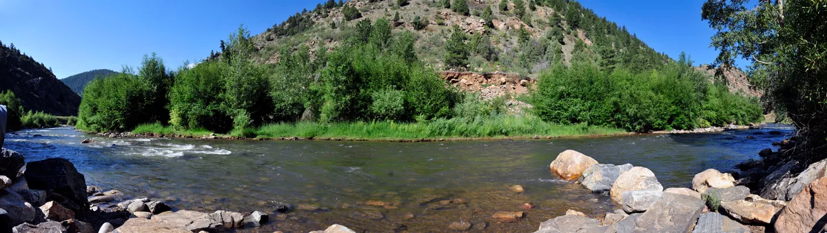
A narrow canyon carved by Clear Creek through Precambrian metamorphic rock west of Golden along U.S. Route 6. The canyon walls rise steeply on both sides, creating dramatic light conditions throughout the day. The creek provides opportunities for long-exposure water photography among the boulders.
Photography Guide
- Best Time
- morning
- Crowds
- Moderate
- Shot Types
- long-exposurelandscapedetail
- Best Seasons
- springsummerfall
Is it a good day to go?
7-day outlookMild, dry days with light winds are the most comfortable for a visit.
Forecast by Open-Meteo. Verdicts weigh the forecast against the conditions that suit this spot.
Author's Comments
The canyon does not give you light easily. That is the first thing to understand. Highway 6 runs the length of it, and the walls climb so steeply on both sides that direct sun reaches the creek for only a narrow window each day. Most of the time you are working in reflected light, the kind that bounces off the rock above and falls onto the water already softened. This is a gift if you came to make long exposures. The shadow holds, the water moves, and a two second frame at the right pullout becomes something quieter than you expected. I come here in late May, when the runoff is loud and the creek is moving real volume between the boulders. The water turns from clear to something closer to jade where it pools, then white where it breaks. I work early. Mornings before the canyon fills with traffic noise and the light is still cool against the metamorphic rock, which is older than almost anything else you will photograph in Colorado. Precambrian. The kind of stone that does not care about your shutter speed. The pullouts are the practical answer. Park, scramble down, find a composition you can live with for ten minutes. The detail work is as good as the wide work here, maybe better. A single boulder split by current. The seam where two rock faces meet at the waterline. I do not think Clear Creek is a place that announces itself. It is a place you have to slow down inside of, which is exactly why I keep driving up Highway 6 when I could be going somewhere more obvious.
Gallery
You might also like
Nearby Places

Golden, CO
Lookout Mountain
Lookout Mountain rises to 7,379 feet and provides panoramic views of the Denver metro area to the east and the Continental Divide to the west. The summit area includes the Buffalo Bill Museum and grave site. The Lariat Loop road ascending the mountain is a historic scenic drive.

Golden, CO
North Table Mountain
A flat-topped mesa formed by lava flows 63 million years ago, rising about 600 feet above the city of Golden. The mesa top offers views of the Continental Divide, Denver skyline, and the town of Golden below. Wildflower displays on the mesa top are notable in late spring and early summer.

Morrison, CO
Matthews/Winters Park
A Jefferson County Open Space park on the Dakota Hogback featuring the Red Rocks Trail that passes through tilted red sandstone formations. The park preserves remnants of the 1859 townsite of Mount Vernon and includes both foothill grasslands and riparian areas. Views extend from the hogback formations across the plains to Denver.