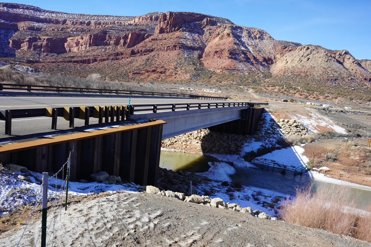
A highway bridge crosses the Dolores River under bright winter sun, with patches of snow on the banks and a small pool of greenish water below. Red and tan canyon walls rise steeply in the background beneath a clear blue sky.

Dolores River Canyon near Dolores

Dolores, CO

The Dolores River canyon below McPhee Dam features red sandstone walls, cottonwood-lined banks, and a clear-flowing river corridor winding through the pinon-juniper landscape. The stretch between the dam and the town of Dolores is accessible from Colorado Highway 145 and offers intimate riparian scenery. Fall color from cottonwoods and willows creates striking contrasts against the red rock.

Photography Guide

Best Time
golden hour
Crowds
Quiet
Shot Types
widelandscapedetailreflection
Best Seasons
springsummerfall
Practical Tips
Several pullouts along Highway 145 between Dolores and the dam offer river access. Fall foliage typically peaks in early to mid-October along this stretch.

Is it a good day to go?

7-day outlook

Mild, dry days with light winds are the most comfortable for a visit.

Forecast by Open-Meteo. Verdicts weigh the forecast against the conditions that suit this spot.

Author's Comments

The Dolores does not announce itself. You drive south from the dam on 145 and the canyon opens slowly, walls rising in that particular Colorado red that goes warmer as the afternoon settles, and the river runs clear and unhurried below. This is not a canyon of grand scale. It is a canyon of intimate proportion, and that is its argument. Mid-October is when I make the drive. The cottonwoods along the banks turn a yellow that is almost aggressive against the sandstone, and on a still morning the river holds both colors at once. The pullouts between town and the dam are unmarked and easy to miss. Stop at the ones that look like nothing. Walk down to the water. The compositions are close in - a single cottonwood leaning over a bend, the trunk of a juniper against red rock, the way the current breaks around a stone and reassembles itself downstream. Golden hour does specific work here. The walls catch light from the west and throw it back across the river, and for maybe twenty minutes the whole corridor goes amber. I have stood in that light and forgotten to make a photograph, which is its own kind of recommendation. This is canyon country at a quieter register. Not the cathedral version. The version where you can hear the water and the wind in the cottonwood leaves and almost nothing else.

Gallery

A highway bridge crosses the Dolores River under bright winter sun, with patches of snow on the banks and a small pool of greenish water below. Red and tan canyon walls rise steeply in the background beneath a clear blue sky. Photo: Steven Baltakatei Sandoval / Wikimedia Commons / CC BY-SA 4.0
The Dolores River winds through a green cottonwood-lined canyon under a clear blue sky, with sunlit banks and dark rippling water. A narrow gravel and brush-covered strip divides the main channel from a shallow side channel on the right. Photo: Jeffrey Beall / Wikimedia Commons / CC BY 4.0
The Dolores River curves around a gravel bar lined with rust-colored grasses and leafless cottonwoods, with red sandstone cliffs rising steeply behind it. Clear water and bright blue sky give the canyon a crisp, open feel. Photo: Jeffrey Beall / Wikimedia Commons / CC BY 4.0
A winding green river cuts through a deep red sandstone canyon, with steep sunlit cliffs on the right and scrub-covered slopes on the left under a clear blue sky. The overlook perspective emphasizes the narrow riparian corridor and layered rock walls. Photo: Coasterlover1994 / Wikimedia Commons / CC BY-SA 4.0
High-angle aerial view over a dark, rugged river canyon landscape, with pale winding rock layers and a few scattered clouds casting shadows below. The airplane window frame curves along the bottom edge, and a thick bank of bright white clouds fills the horizon under a deep blue sky. Photo: Designism / Wikimedia Commons / CC0
A clear mountain river winds through a green valley lined with dense evergreens and shrubs, with rounded slopes rising on both sides under a sky of thick white clouds and blue openings. The rocky streambed and sunlit grasses give the scene a late-summer feel. Photo: PGHolbrook / Wikimedia Commons / CC BY-SA 3.0
A shaded relief map of western Colorado and eastern Utah traces the Dolores River basin in bold blue, with major tributaries, town labels, and county names marked across the terrain. An inset map at lower left highlights the basin’s location within the broader region. Photo: Shannon1 / Wikimedia Commons / CC BY-SA 4.0
A map view traces the Dolores River in a thick blue line through southwestern Colorado, with the highlighted section winding past Dove Creek toward the canyon near Dolores. The route cuts across pale, shaded terrain and green forested areas, with nearby town labels like Montrose, Telluride, and Delta visible. Photo: DescriptionDolores (rivière) OSM.png This map was created from OpenStreetMap project data, collected by the community. This map may be incomplete, and may contain errors. Don't rely solely on it for navigation. Date (see file history) Source openstreetmap.org Creator OpenStreetMap contributors Permission(Reusing this file) OpenStreetMap data is available under the Open Database License (details). Map tiles are licensed under the Creative Commons Attribution-ShareAlike 2.0 license (CC-BY-SA 2.0). This work contains information from OpenStreetMap, which is made available under the Open Database License (ODbL). The ODbL does not require any particular license for maps produced from ODbL data. Prior to 1 August 2020, map tiles produced by the OpenStreetMap Foundation were licensed under the CC-BY-SA-2.0 license. Maps produced by other people may be subject to other licences.Open Database LicenseODbLhttp://opendatacommons.org/licenses/odbl/1.0/true This file is licensed under the Creative Commons Attribution-Share Alike 2.0 Generic license. You are free: to share – to copy, distribute and transmit the work to remix – to adapt the work Under the following conditions: attribution – You must give appropriate credit, provide a link to the license, and indicate if changes were made. You may do so in any reasonable manner, but not in any way that suggests the licensor endorses you or your use. share alike – If you remix, transform, or build upon the material, you must distribute your contributions under the same or compatible license as the original.https://creativecommons.org/licenses/by-sa/2.0CC BY-SA 2.0 Creative Commons Attribution-Share Alike 2.0 truetrue Georeferencing Georeference the map in Wikimaps Warper If inappropriate please set warp_status = skip to hide. / Wikimedia Commons / CC BY-SA 4.0
A red canoe rests on a rocky riverbank beside the low, dark water of the Dolores River, with red sandstone boulders and cottonwood-lined canyon slopes stretching into the distance. Soft golden-hour light warms the scene under a sky filled with scattered white clouds. Photo: Cawright2007 / Wikimedia Commons / CC BY-SA 3.0
A winding river glints through the canyon, bordered by dense green cottonwoods and tall grasses beneath layered red sandstone cliffs. Sunlit rock walls frame the scene under a clear blue sky, with the river curving into the distance. Photo: Alex Moliski / Pexels

You might also like

Nearby Places