Dominguez-Escalante National Conservation Area
Delta, CO
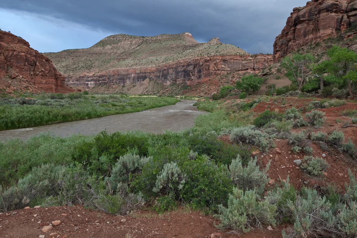
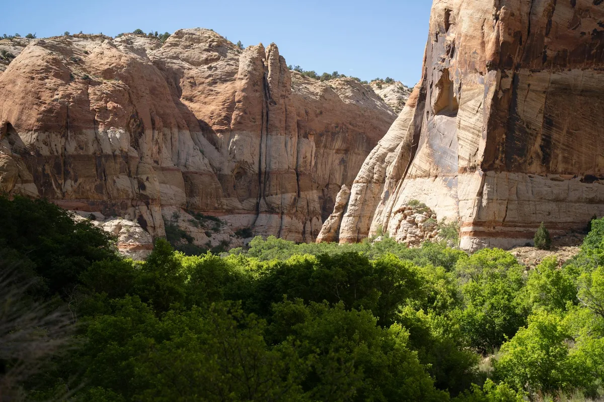
The Dominguez-Escalante NCA encompasses red sandstone canyons carved by Dominguez and Escalante Creeks as they flow toward the Gunnison River. The area features Entrada and Wingate sandstone walls, seasonal waterfalls, and Ancestral Puebloan rock art. Big Dominguez Canyon is the primary photographic destination.
Photography Guide
- Best Time
- morning
- Crowds
- Quiet
- Shot Types
- widelandscapedetail
- Best Seasons
- springfall
Is it a good day to go?
7-day outlookMild, dry days with light winds are the most comfortable for a visit.
Forecast by Open-Meteo. Verdicts weigh the forecast against the conditions that suit this spot.
Author's Comments
Most people drive past it. The signs for Dominguez-Escalante are easy to miss on US 50, and the trailhead at Bridgeport sits at the end of a dirt road that does not particularly invite you in. That is part of the gift. Twelve miles round trip is enough distance to thin the foot traffic to almost nothing, and what you find at the end of that walk is a canyon that feels like it has been waiting a long time without much company. I went in late April. The creek was running, which matters here, because the seasonal waterfall in Big Dominguez is the kind of thing that exists for a few weeks and then disappears into dry stone for the rest of the year. The walls are Wingate and Entrada, which is to say they are the deep oxidized red that the Colorado Plateau does better than anywhere else, and in morning light they hold heat and color in a way that flattens by noon. Get there early. The shadows are still long across the canyon floor, the water is loud in a way it will not be by July, and the rock art panels read more clearly when the sun is raking across them rather than coming down from above. This is a place to bring a wide lens for the canyon and a longer one for the petroglyphs. It is also a place to walk slowly and not photograph everything. The restraint is part of the experience. So is the quiet.
Gallery
You might also like
Nearby Places
Delta, CO
Escalante Canyon
Escalante Canyon is a quiet agricultural canyon south of Delta where the Escalante Creek has carved through layers of red and brown sandstone. Historic Captain Smith's Cabin, a one-room log structure from 1910, sits in the canyon along a dirt road. Spring brings wildflowers and flowing water to the seasonal creek.
Grand Junction, CO
Unaweep-Tabeguache Scenic Byway - Unaweep Canyon
Unaweep Canyon is a geologically unique canyon with the rare feature of having two creeks flowing in opposite directions from a central divide. The canyon walls expose 1.7-billion-year-old Precambrian granite and gneiss capped by Wingate sandstone. The Unaweep Divide at 7,048 feet marks the point where West Creek and East Creek separate.

Delta, CO
Grand Mesa - Land O' Lakes Overlook
Grand Mesa is the largest flat-topped mountain in the world, rising over 10,000 feet and containing more than 300 alpine lakes. The Land O' Lakes viewpoint on Grand Mesa Scenic Byway provides sweeping views across the mesa's lake-dotted plateau. Fall brings extensive aspen color across the mesa's slopes.