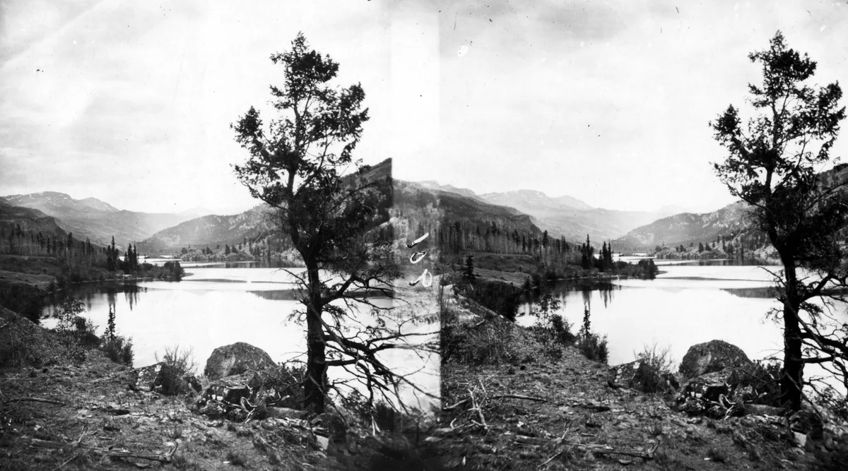
Lake San Cristobal
Lake City, CO
Lake San Cristobal is the second largest natural lake in Colorado, formed approximately 700 years ago by the Slumgullion Earthflow landslide that dammed the Lake Fork of the Gunnison River. The lake is surrounded by dense forests and mountain peaks that provide vivid fall color reflections. It is located two miles south of the historic mining town of Lake City.
Photography Guide
- Best Time
- golden hour
- Crowds
- Quiet
- Shot Types
- widelandscapereflection
- Best Seasons
- summerfall
Is it a good day to go?
7-day outlookMild, dry days with light winds are the most comfortable for a visit.
Forecast by Open-Meteo. Verdicts weigh the forecast against the conditions that suit this spot.
Author's Comments
The first time I drove down from Lake City to see San Cristobal, I arrived too late in the morning and the wind had already started working the surface. I came back the next day at five thirty and understood. This lake wants to be photographed at first light, before anything else has woken up, when the water has gone completely still and the mountains behind it double themselves on the surface with a precision that does not feel quite real. Late September is when I would tell you to come. The aspens on the slopes above the lake turn in waves, and because the lake is held in a basin of dense forest and high peaks, the color comes at you from every direction at once. Reflected, it doubles. The Slumgullion that dammed this water seven hundred years ago left a shoreline that is irregular and interesting, with coves and inlets that give a long lens something to find. From the eastern side near the road, the composition is wide and classic - water, color, peaks, sky in clean horizontal bands. From a kayak on the water itself, the photograph changes entirely. The shoreline becomes the subject and the reflections wrap around you. The crowds here are nothing like Maroon Bells or Hanging Lake. That is part of what makes it. You can have a morning to yourself and the only sound will be the occasional loon and your own shutter. Bring layers. The basin holds cold air well into the summer, and at golden hour in October you will want gloves you can shoot in.
Gallery
You might also like
Nearby Places
Lake City, CO
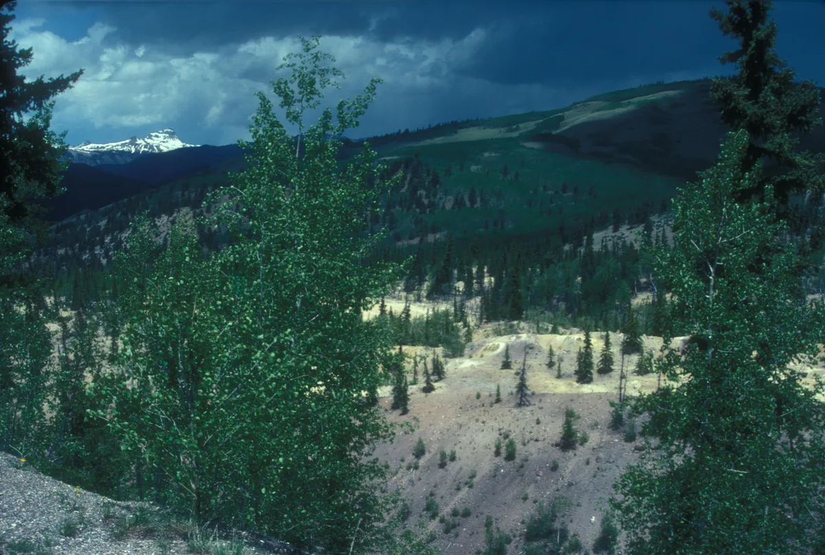
Slumgullion Pass and Earthflow
Slumgullion Pass at 11,530 feet provides a viewpoint over one of the most visually distinctive landslides in North America, the Slumgullion Earthflow. The still-active landslide displays a striking yellow-green color caused by mineral-stained clay visible against the surrounding green forest. An interpretive overlook on the Silver Thread Scenic Byway offers direct views of the entire slide path.
Creede, CO
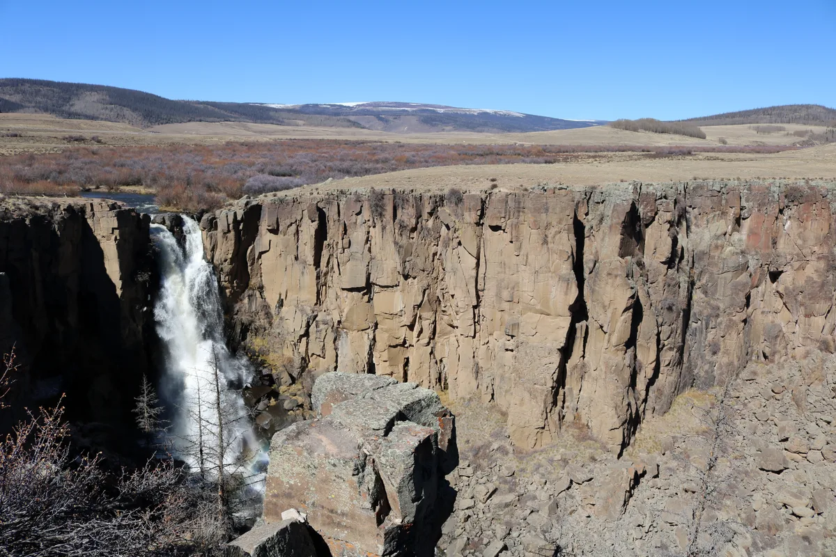
North Clear Creek Falls
North Clear Creek Falls is a 100-foot waterfall that plunges over a rhyolite cliff into a rocky gorge. A short paved trail leads to an overlook with a direct view of the falls surrounded by dense spruce forest. The waterfall is located along the Silver Thread Scenic Byway between Lake City and Creede.

Lake City, CO
Engineer Pass
Engineer Pass is a 12,800-foot alpine pass connecting Lake City to Ouray and Silverton via a historic mining road. The summit offers 360-degree views of the San Juan Mountains including Uncompahgre Peak and Wetterhorn Peak. Ruins of the Frank Hough Mine and other historic mining structures are scattered along the route.