Photo spots nearby
What to see near Dunton Hot Springs
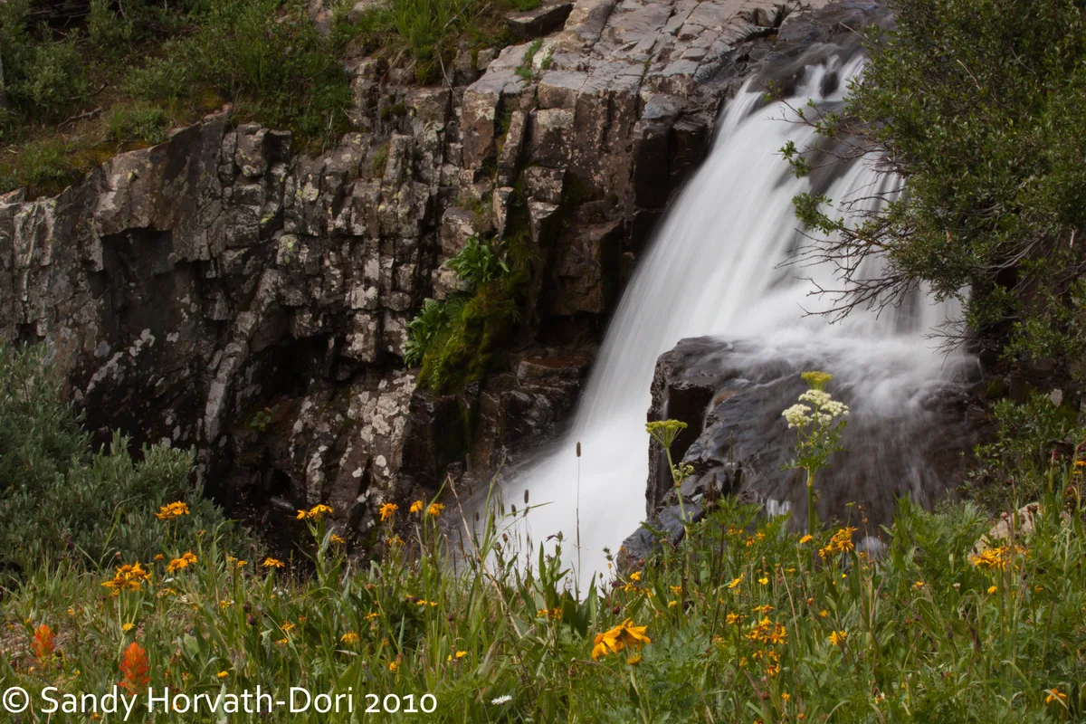
Telluride earns its reputation not just for the town itself, beautiful as it is, but for the road that leads away from it. Take Last Dollar Road north out of town when you have a few unhurried hours, and you'll find yourself winding through open aspen groves and wide ranch meadows with the San Juan peaks rising behind you in every direction. Then come back down into the box canyon itself and look up at Bridal Veil Falls dropping 365 feet from the lip of the plateau, the old powerhouse still perched at the top like something left behind by a dream. Telluride rewards slowness. Walk the length of Colorado Avenue, let the canyon walls close around you, and understand why people come here once and never quite leave.
Within 25 miles · ranked by scenic score
12 Places Worth Seeing
Silverton, CO
Ice Lake Basin
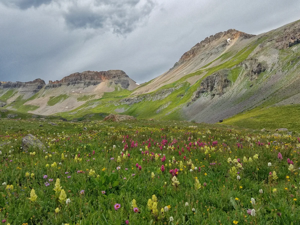
Ice Lake sits at 12,585 feet in a glacial cirque surrounded by the dramatic peaks of Vermillion, Golden Horn, and Pilot Knob. The lake is known for its impossibly vibrant turquoise color, set against lush wildflower meadows in midsummer. The basin also includes Island Lake, another photogenic alpine destination.

Telluride, CO
Telluride Town and Box Canyon
Telluride sits at 8,750 feet within a dramatic glacially carved box canyon surrounded on three sides by steep mountain walls reaching 13,000 feet. The town's Victorian-era Colorado Avenue is framed by the surrounding peaks and multiple visible waterfalls including Ingram Falls and Bridal Veil Falls. The free gondola between Telluride and Mountain Village provides aerial perspectives of the entire valley.
Silverton, CO
Ophir Pass
Ophir Pass is a 11,789-foot alpine pass between Silverton and Telluride that follows a historic toll road built in 1881. The Silverton side features expansive views of the mineral-stained peaks of the Red Mountain mining district. Near the summit, the road traverses above timberline with vast open tundra and scattered wildflowers.
Telluride, CO
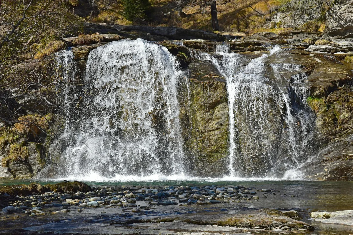
Bridal Veil Falls
At 365 feet, Bridal Veil Falls is the tallest free-falling waterfall in Colorado. A historic hydroelectric power plant sits at the top of the falls and is one of the oldest alternating current power plants still operating in the world. The falls are visible from the east end of Telluride's box canyon.

Telluride, CO
Last Dollar Road
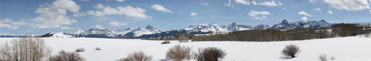
Last Dollar Road is a high-mountain dirt road connecting Telluride to Ridgway via Dallas Divide, passing through vast aspen groves with views of the Wilson Range and Mount Sneffels Wilderness. In autumn, the road is surrounded by dense golden aspens that create some of the most photographed fall color scenes in Colorado. Split-rail fences and old ranch meadows add foreground interest.

Ridgway, CO
Blue Lakes Trail
A series of three stunning alpine lakes nestled beneath the towering north face of Mount Sneffels. The lakes sit at elevations between 11,000 and 12,800 feet and are renowned for their vivid turquoise coloring caused by glacial minerals. Wildflower meadows surround the lower lakes during July and August.

Silverton, CO
Molas Pass Overlook
Molas Pass sits at 10,910 feet on U.S. Route 550 between Silverton and Durango with a developed overlook offering panoramic views of the Grenadier Range and the Animas River valley far below. Molas Lake is visible in the foreground, reflecting the surrounding peaks on calm mornings. The area is known for dramatic cloud formations and sweeping alpine vistas.
Ridgway, CO
Dallas Divide
Dallas Divide on Highway 62 between Ridgway and Placerville is one of the most iconic roadside viewpoints in Colorado, offering a classic view of the Wilson Range including Mount Wilson, Wilson Peak, and El Diente. In autumn, foreground meadows and aspen groves frame the distant peaks in gold and orange. Rail fences along the highway add a quintessential Western element.
Ouray, CO
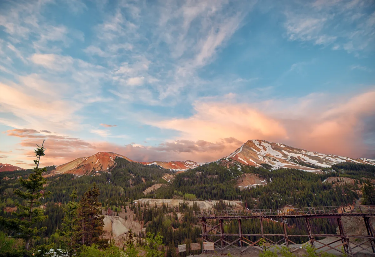
Million Dollar Highway - Red Mountain Pass
Red Mountain Pass sits at 11,018 feet along U.S. Route 550, the famous Million Dollar Highway connecting Ouray and Silverton. The surrounding peaks are stained vivid red and orange from iron oxide mineralization. Several pullouts offer views of the barren, colorful peaks and remnants of historic mining operations.

Durango, CO
Purgatory Flats via Cascade Creek Trail
Purgatory Flats is a secluded high-mountain meadow nestled along the Animas River in the Weminuche Wilderness, accessible from the Cascade Creek trailhead near Purgatory Resort. The trail passes through old-growth spruce and fir forests before opening to a wide flat valley surrounded by towering peaks. The meadow offers excellent foreground for wildflower and mountain compositions.
Ouray, CO
Yankee Boy Basin
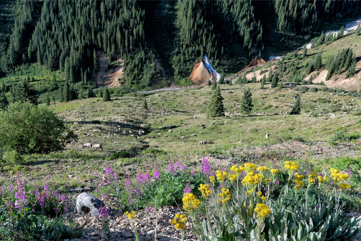
Yankee Boy Basin is a high alpine basin at approximately 12,000 feet that lies below the summit of Mount Sneffels, one of Colorado's 14ers. The basin is widely regarded as one of the most spectacular wildflower destinations in the state, with dense carpets of columbine, paintbrush, and sunflowers in July. Ruins of historic mines dot the surrounding hillsides.
Silverton, CO
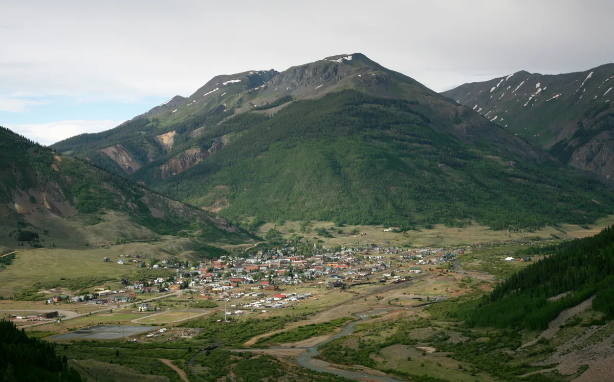
Silverton Historic District
Silverton's entire downtown is a National Historic Landmark District with well-preserved Victorian-era mining town architecture dating from the 1880s and 1890s. Greene Street features colorful storefronts, the 1902 Town Hall, and the Grand Imperial Hotel against a dramatic backdrop of 13,000-foot peaks. The town sits at 9,318 feet in a high mountain basin surrounded by the San Juan Mountains.
Discover more
Browse the full COSights atlas — 100+ curated spots across Colorado.